A group in Amherst that has saved more than 19,000 acres of farmland, forest, and wetlands in the Valley is fighting to protect more than 1,000 acres in the Amherst area “Range” that is at risk of being turned into parking lots, roads, strip malls, vacation homes and other kinds of so-called “development.”
Kristin DeBoer is director of www.KestrelTrust.org. “If you live in one of the seven towns that cover the Range – Amherst, Belchertown, Easthampton, Granby, Hadley, Holyoke, South Hadley – please contact your town’s conservation commission to let them know that land conservation on the Range should be a priority for your town,” DeBoer said.
People who live in other Massachusetts towns and want to see the land saved should contact their state legislators and ask them to support H4128, “An Act providing for the preservation and improvement of land, parks, and clean energy in the Commonwealth,” DeBoer said. Contact information for state legislators is at: www.maLegislature.gov
Land conservation groups for the Brattleboro area are www.vlt.org and for the Keene area www.MonadnockConservancy.org.
--------
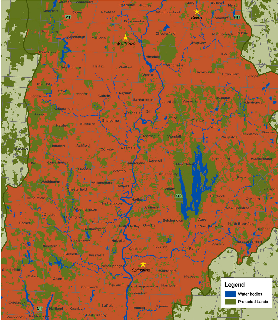
Map by the Trust for Public Land, 2006. This map shows the Pioneer Valley section of the Connecticut River watershed. Land outside the watershed is light green, meaning streams in that area do not flow to the Connecticut River. Dark green land has been protected from development. Red land is vulnerable to being paved with McMansions, Wal-Marts, parking lots, roads, and ChemLawns. Click on the map to enlarge.
Post new comment